#FileExchange #UpdateRecently
Antarctic boundaries, grounding line, and masks from InSAR
http://bit.ly/2YyZT0Y
Antarctic boundaries, grounding line, and masks from InSAR
http://bit.ly/2YyZT0Y
ww2.mathworks.cn
Antarctic boundaries, grounding line, and masks from InSAR - File Exchange - MATLAB Central
A complete MEaSUREs grounding line, coast line, and mask dataset from Mouginot et al.
#FileExchange #UpdateRecently
CSF: Ground filtering of point cloud based on Cloth Simulati
http://bit.ly/2QckyF3
CSF: Ground filtering of point cloud based on Cloth Simulati
http://bit.ly/2QckyF3
ww2.mathworks.cn
CSF: Ground filtering of point cloud based on Cloth Simulati - File Exchange - MATLAB Central
A novel easy-to-use ground filtering (bare-earth extraction) algorithm for point cloud processing.
#FileExchange #UpdateRecently
Penetration depth evaluation at L- and S-band SAR signals
http://bit.ly/2Hqnb3s
Penetration depth evaluation at L- and S-band SAR signals
http://bit.ly/2Hqnb3s
ww2.mathworks.cn
Penetration depth evaluation at L- and S-band SAR signals - File Exchange - MATLAB Central
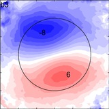
Comparison of penetration depth at L band. First, the dielectric constant of the soil-water mixture is calculated using two empirical models
#FileExchange #UpdateRecently
DEM: Shaded relief image plot (digital elevation model)
http://bit.ly/2VCExxQ
DEM: Shaded relief image plot (digital elevation model)
http://bit.ly/2VCExxQ
ww2.mathworks.cn
DEM: Shaded relief image plot (digital elevation model) - File Exchange - MATLAB Central
Pretty shaded relief map as flat image.
#FileExchange #UpdateRecently
IBCSO International Bathymetric Chart of the Southern Ocean
http://bit.ly/2QcyD5w
IBCSO International Bathymetric Chart of the Southern Ocean
http://bit.ly/2QcyD5w
ww2.mathworks.cn
IBCSO International Bathymetric Chart of the Southern Ocean - File Exchange - MATLAB Central
Access, interpolate, and plot DEM data