The recent
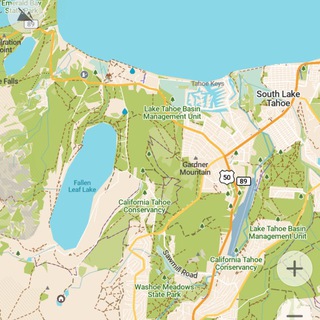
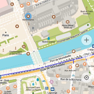
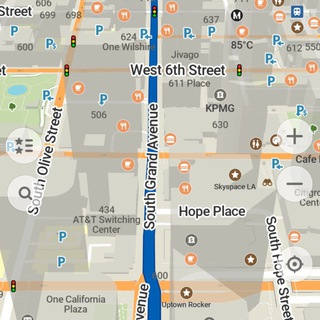
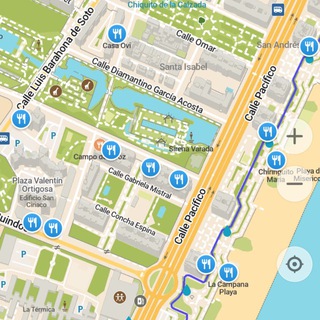
In addition to the updated maps (as of June 22) and related features (improved altitude isolines, improved and added color fills for some map objects, updated map icons etc.), the iOS version has the following specific changes:
- Now actually ending a search when a route starts
- Made sure the whole location button is visible during routing
- Removed a thin black line, that appeared on the app icon on some devices
The update hasn't landed on F-Droid yet, it'd take 2-3 more days.
2025.06.30-22 release has now reached Google Play and App Store!In addition to the updated maps (as of June 22) and related features (improved altitude isolines, improved and added color fills for some map objects, updated map icons etc.), the iOS version has the following specific changes:
- Now actually ending a search when a route starts
- Made sure the whole location button is visible during routing
- Removed a thin black line, that appeared on the app icon on some devices
The update hasn't landed on F-Droid yet, it'd take 2-3 more days.
Google Play
CoMaps - Navigate with Privacy - Apps on Google Play
Easy map navigation - Discover more of your journey - Powered by the community
❤12⚡5👏2
A new iOS TestFlight version
https://codeberg.org/comaps/comaps/issues/698
Changes since the last test build:
- OpenStreetMap data as of June 22
- Switched everything with the OpenStreetMap profile (including login) to more modern technologies
- Changed how the greenery system works to have colors more consistent over different zoom levels (#669)
- Matched parking color in navigation mode to the normal map style
- Rendering paths and track now at same level as footways and cycleways (by @eisa01)
- Slight adjustments to the opacity of footways and backgrounds for general areas (#684 & #658)
- Removed a thin black line, that appeared on the app icon on some devices
- Updated social media links (by @map-per)
- OpenStreetMap profile more responsive with bad network condition
2025.07.01-4 is available!https://codeberg.org/comaps/comaps/issues/698
Changes since the last test build:
- OpenStreetMap data as of June 22
- Switched everything with the OpenStreetMap profile (including login) to more modern technologies
- Changed how the greenery system works to have colors more consistent over different zoom levels (#669)
- Matched parking color in navigation mode to the normal map style
- Rendering paths and track now at same level as footways and cycleways (by @eisa01)
- Slight adjustments to the opacity of footways and backgrounds for general areas (#684 & #658)
- Removed a thin black line, that appeared on the app icon on some devices
- Updated social media links (by @map-per)
- OpenStreetMap profile more responsive with bad network condition
Codeberg.org
iOS Test Build 2025.07.01-4
This is the public TestFlight for iOS:
https://testflight.apple.com/join/EGSsGRn7
The available space for beta testers is limited. So if the beta is full, maybe check again at some point later. Just use the [official App Store version](https://apps.a…
https://testflight.apple.com/join/EGSsGRn7
The available space for beta testers is limited. So if the beta is full, maybe check again at some point later. Just use the [official App Store version](https://apps.a…
⚡8❤1
We're thrilled to announce the General Availability of CoMaps on Google Play Store, Apple App Store, and F-Droid!
This is a significant milestone, and as active members of the CoMaps community, you can support the announcement of GA by:
- Re-posting to other resources you know
- Spreading the word
- Celebrating!
We have an amazing community, thank you!
This is a significant milestone, and as active members of the CoMaps community, you can support the announcement of GA by:
- Re-posting to other resources you know
- Spreading the word
- Celebrating!
We have an amazing community, thank you!
❤41👏8🔥5🎉3👍2❤🔥1🦄1👾1
Just days since launch, and CoMaps is already making waves! Many have downloaded the new navigation app, and the reviews are rolling in!
From fast directions to support of the CoMaps principles, people are loving the way CoMaps makes getting around.
– “Finally the freedom and privacy respecting open source map app I needed.. and finally not for profit!”
– “Great start for a community run fork. I already donated, and really hope the development can keep up with that of Organic Maps.”
– “forked, improved, released, love it.”
Thank you to everyone sharing the love — and tell your friends. This is just the beginning.
From fast directions to support of the CoMaps principles, people are loving the way CoMaps makes getting around.
– “Finally the freedom and privacy respecting open source map app I needed.. and finally not for profit!”
– “Great start for a community run fork. I already donated, and really hope the development can keep up with that of Organic Maps.”
– “forked, improved, released, love it.”
Thank you to everyone sharing the love — and tell your friends. This is just the beginning.
❤36👍8
Choose the final CoMaps logo!
After dozens of ideas and tons of iteration in the community, we’re down to the final 6 logo designs — and your vote will help decide which one becomes the official face of CoMaps.
This isn’t just a design — it’s a symbol of open maps, privacy-respecting navigation, and a global community.
– Sign in to vote now, and be part of CoMaps history: https://codeberg.org/comaps/Governance/issues/102
– Voting closes: July 11
Let’s build this together!
After dozens of ideas and tons of iteration in the community, we’re down to the final 6 logo designs — and your vote will help decide which one becomes the official face of CoMaps.
This isn’t just a design — it’s a symbol of open maps, privacy-respecting navigation, and a global community.
– Sign in to vote now, and be part of CoMaps history: https://codeberg.org/comaps/Governance/issues/102
– Voting closes: July 11
Let’s build this together!
❤22⚡4👍2
CoMaps-25071028-web-test.apk
50.6 MB
Android test build
https://codeberg.org/comaps/comaps/issues/818
- display opening hours state in the place page preview (by @hbond)
- voice instructions: skip roundabout name and distance to the exit (by @bluelight_henry)
- reduce initial delay when downloading maps (by @pastk)
- update downloader notification icon (by @hb0nd)
- update some UI icons (by @jeanbaptisteC)
- migrate some UI elements to material components (by @jeanbaptisteC)
- update translations (thanks to many translators!)
Map Style improvements (mostly by @yannikbloscheck):
- rework vegetation colours (the greens) - more consistent and no sudden changes when zooming
- improved rivers, streams etc. - same colour for lines and areas, also a bit thicker
- improved cutlines colour
- tune pedestrian and general areas fill colours
- footways are a bit brighter now
- change color of garages landuse (by @pastk)
- update transport bookmark icon and related map icons
2025.07.10-28-testhttps://codeberg.org/comaps/comaps/issues/818
- display opening hours state in the place page preview (by @hbond)
- voice instructions: skip roundabout name and distance to the exit (by @bluelight_henry)
- reduce initial delay when downloading maps (by @pastk)
- update downloader notification icon (by @hb0nd)
- update some UI icons (by @jeanbaptisteC)
- migrate some UI elements to material components (by @jeanbaptisteC)
- update translations (thanks to many translators!)
Map Style improvements (mostly by @yannikbloscheck):
- rework vegetation colours (the greens) - more consistent and no sudden changes when zooming
- improved rivers, streams etc. - same colour for lines and areas, also a bit thicker
- improved cutlines colour
- tune pedestrian and general areas fill colours
- footways are a bit brighter now
- change color of garages landuse (by @pastk)
- update transport bookmark icon and related map icons
🔥9⚡4👍1
And a new iOS Test Build
https://codeberg.org/comaps/comaps/issues/825
Changes since the last test build:
- Switched the settings to using more modern technologies
- Reassignable left main button
- Reduce initial delay when downloading maps (by @pastk)
- Fixed reappearing OSM login prompt at certain occasions
- Skip roundabout name and distance to the exit in voice instructions (by @bluelight_henry)
- Rounded download percentage
- Public transport bookmark icon now matching the new transport icons style
- Added missing translations for "Saved" button
Notable changes in the last test builds:
- OpenStreetMap data as of June 22
- Changed how the greenery system works to have colors more consistent over different zoom levels
2025.07.10-1 (by @yannikbloscheck)https://codeberg.org/comaps/comaps/issues/825
Changes since the last test build:
- Switched the settings to using more modern technologies
- Reassignable left main button
- Reduce initial delay when downloading maps (by @pastk)
- Fixed reappearing OSM login prompt at certain occasions
- Skip roundabout name and distance to the exit in voice instructions (by @bluelight_henry)
- Rounded download percentage
- Public transport bookmark icon now matching the new transport icons style
- Added missing translations for "Saved" button
Notable changes in the last test builds:
- OpenStreetMap data as of June 22
- Changed how the greenery system works to have colors more consistent over different zoom levels
❤5⚡4
Introducing the CoMaps Logo!
We're proud to reveal the logo for CoMaps — designed and chosen by the community.
From maps to code to design, CoMaps is 100% community-powered — and this logo is no different. It’s a symbol of what we’re building together: free, open, and offline map navigation for everyone.
The winning logo was created by @Flummic. The initial round had 21 logos submitted, resulting in 6 finalists, followed by an iteration process where people collaborated to make improvements (https://codeberg.org/comaps/Governance/issues/78).
Thank you to everyone who shaped this milestone. We’re just getting started.
We're proud to reveal the logo for CoMaps — designed and chosen by the community.
From maps to code to design, CoMaps is 100% community-powered — and this logo is no different. It’s a symbol of what we’re building together: free, open, and offline map navigation for everyone.
The winning logo was created by @Flummic. The initial round had 21 logos submitted, resulting in 6 finalists, followed by an iteration process where people collaborated to make improvements (https://codeberg.org/comaps/Governance/issues/78).
Thank you to everyone who shaped this milestone. We’re just getting started.
❤46🎉8🔥5👏5😍5👍4⚡3👌1🏆1👀1😎1
A new iOS Test Build
https://codeberg.org/comaps/comaps/issues/892
Changes since the last test build:
- New logo
- Switched the section for help and about the app to using more modern technologies
- Made the interface in dark mode darker like it is in the system
- Different icon and color adjustments
- Hiding voice guidance test button, if voice guidance is disabled
2025.07.15-2 (by @yannikbloscheck)https://codeberg.org/comaps/comaps/issues/892
Changes since the last test build:
- New logo
- Switched the section for help and about the app to using more modern technologies
- Made the interface in dark mode darker like it is in the system
- Different icon and color adjustments
- Hiding voice guidance test button, if voice guidance is disabled
❤12🔥4👍2
CoMaps is a community, shaped by people who believe maps can be better: more private, more accessible, and more accurate.
People downloaded CoMaps in 118 countries – from mountains to coastlines, from rural backroads to bustling cities, people around the world are using CoMaps to navigate offline.
People downloaded CoMaps in 118 countries – from mountains to coastlines, from rural backroads to bustling cities, people around the world are using CoMaps to navigate offline.
🔥27👍10👏5🎉4
CoMaps-25072018-web-test.apk
50.6 MB
Android test build
https://codeberg.org/comaps/comaps/issues/963
- update to the new CoMaps logo!
- display address ranges as 123-456 instead of 123:456 (by @zyphlar)
- average the displayed speed for devices with frequent location updates (by @gekeleda)
- outdoors: bolder altitude contour lines (by @pastk)
- outdoors: more contrast waterways (by @yannikbloscheck)
- colder construction areas color (by @pastk)
- update icons for sports centers and dance venues (by @riadok)
- adjust golf courses color (by @yannikbloscheck)
- update public transport bookmark icon for dark style (by @yannikbloscheck)
- fix random Android 14+ crash when starting navigation (by @pastk)
- update translations (thanks to many translators!)
2025.07.20-18-testhttps://codeberg.org/comaps/comaps/issues/963
- update to the new CoMaps logo!
- display address ranges as 123-456 instead of 123:456 (by @zyphlar)
- average the displayed speed for devices with frequent location updates (by @gekeleda)
- outdoors: bolder altitude contour lines (by @pastk)
- outdoors: more contrast waterways (by @yannikbloscheck)
- colder construction areas color (by @pastk)
- update icons for sports centers and dance venues (by @riadok)
- adjust golf courses color (by @yannikbloscheck)
- update public transport bookmark icon for dark style (by @yannikbloscheck)
- fix random Android 14+ crash when starting navigation (by @pastk)
- update translations (thanks to many translators!)
⚡16❤4🔥4👏2
CoMaps is powered by OpenStreetMap — the map created by people, for people.
Thousands of local contributors around the world help keep it accurate, up-to-date, and truly community-driven. A mountain trail, a new road, or a hidden café - chances are it was added by someone who knows the area best.
CoMaps builds on this rich, open data to bring you offline navigation— maps that work anywhere.
Thank you to everyone contributing to OpenStreetMap — you make CoMaps possible!
Thousands of local contributors around the world help keep it accurate, up-to-date, and truly community-driven. A mountain trail, a new road, or a hidden café - chances are it was added by someone who knows the area best.
CoMaps builds on this rich, open data to bring you offline navigation— maps that work anywhere.
Thank you to everyone contributing to OpenStreetMap — you make CoMaps possible!
❤26👍11⚡5🙏2🦄2
A new iOS Test Build
https://codeberg.org/comaps/comaps/issues/988
Changes since the last test build:
- Added setting to change map appearance separately for general interface appearance
- Made it possible to actually stop a track recording without saving
- Always removing the selected action for the left button from the main menu and added help to it
- Update icons for sports centers and dance venues (by @riadok)
- Made postbox icon better recognizable
- Using hyphens instead of colons for address ranges (by @zyphlar)
- Minor improvements to vehicle style and isolines (by @pastk)
- Made bookmarks details editable more quickly on the place page and other small changes (via the OM project)
- Updated translations (by our many great translators)
2025.07.21-1 (by @yannikbloscheck)https://codeberg.org/comaps/comaps/issues/988
Changes since the last test build:
- Added setting to change map appearance separately for general interface appearance
- Made it possible to actually stop a track recording without saving
- Always removing the selected action for the left button from the main menu and added help to it
- Update icons for sports centers and dance venues (by @riadok)
- Made postbox icon better recognizable
- Using hyphens instead of colons for address ranges (by @zyphlar)
- Minor improvements to vehicle style and isolines (by @pastk)
- Made bookmarks details editable more quickly on the place page and other small changes (via the OM project)
- Updated translations (by our many great translators)
🔥6👍3⚡1